Sometimes a geography lesson is the only way in. Especially with something as humungous as the Himalayas. The name Joshimath comes from Jyotirmath — meaning ‘abode of light’ — a name that Adi Shankaracharya gave this small hill town in the 8th century when he sat in meditation beneath a 1,200-year-old mulberry tree and, according to the stories, achieved enlightenment. The tree, the Kalpavriksha, still stands. You can still sit under it. And the peaks behind it — Nanda Devi, Hathi Parvat, Dronagiri, Kamet — have not moved an inch.
But here is what the geography books don’t always tell you. Joshimath sits at 6,150 feet above sea level at the exact point where the Alaknanda and the Dhauliganga rivers meet at Vishnuprayag below. It is not just a spiritual crossroads. It is a trekking crossroads. Every major Himalayan trail in this part of Garhwal — every bugyal, every pass, every summit, every flower-filled valley — either starts here or passes through here. It is the base before the mountains, and the welcome back after them.
We are Blackberry Cottages. We live at the doorstep of all of this. And if there is one thing we have learned from hosting trekkers, pilgrims, skiers and mountain wanderers, it is that most people arrive in Joshimath without quite knowing how much is on offer. This guide is for them. And perhaps for you.
Before You Choose a Trek: One Thing You Must Do in Joshimath
Acclimatization. Not optional. Not something to skip because you feel fine off the bus. Joshimath sits at 6,150 feet — and nearly every trek from here climbs to 11,000, 12,500 or 15,000 feet within a few days. The ‘climb high, sleep low’ principle exists for a reason. Your body needs time to produce more red blood cells, to adjust to the thinner air, to stop that low-grade headache you are probably already ignoring.
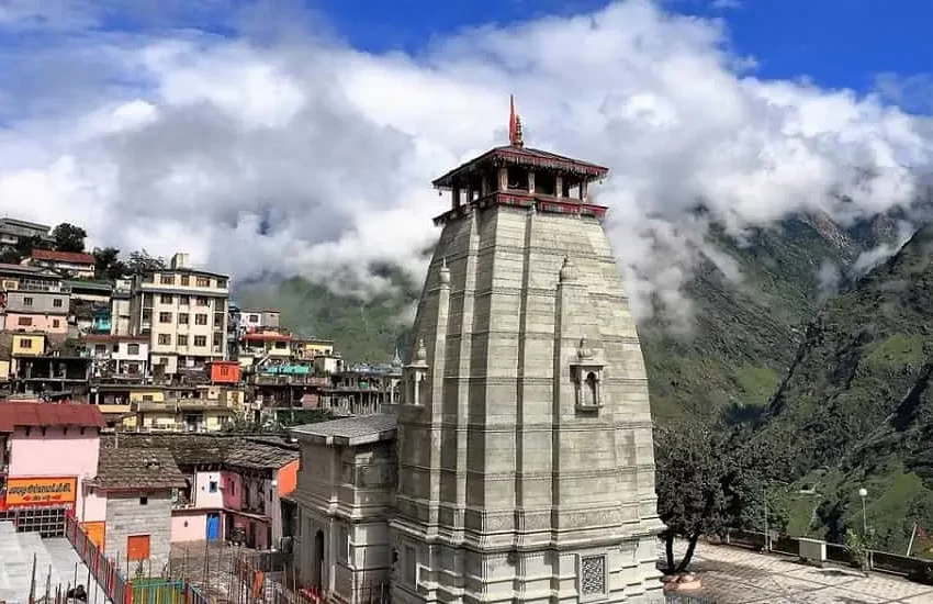
Spend at least one night in Joshimath before you set foot on any trail. Two nights is better. Use that time wisely. Walk the steep lanes of the bazaar. Visit the Narsingh Temple — ancient, calming, and home to an idol of Lord Vishnu whose thin wrist, according to local legend, will herald the end of Kaliyuga when it finally breaks. Sit at the Shankaracharya Math. Drink chai. Watch the light fall on Hathi Parvat at dusk. Your lungs are working. Let them.
Acclimatization Checklist Before Any Trek From Joshimath
- Spend minimum 1 night (ideally 2) in Joshimath before trekking
- Walk at an easy pace — no rushing up the bazaar lanes on arrival day
- Drink 3–4 litres of water daily, starting from Rishikesh
- Avoid alcohol and smoking for 48 hours before and during the trek
- Mild headache is normal; persistent headache, nausea, or dizziness — descend immediately
- Eat light — dal, rice, sabji. Your digestive system is adjusting too
- Sleep is where the acclimatization actually happens. Protect it
At a Glance: All the Treks from Joshimath
There are six treks that genuinely begin from Joshimath or its immediate radius — each one completely different in character, difficulty, and season. Here is the map before we go into the detail.
| Trek | Max Altitude | Duration | Difficulty | Best Season |
|---|---|---|---|---|
| Kuari Pass | 12,516 ft | 5–6 days | Easy–Moderate | Oct–May |
| Pangarchulla Peak | 15,069 ft | 6–7 days | Moderate–Hard | Mar–May, Sep–Nov |
| Gorson Bugyal | 10,023 ft | 1–2 days | Easy | Apr–Jun, Sep–Dec |
| Valley of Flowers | 11,778 ft | 6–7 days | Easy–Moderate | Aug–Sep |
| Nanda Devi Base Camp | 14,000 ft+ | 8–10 days | Difficult | May–Jun, Sep |
| Joshimath to Auli | 8,530 ft | Half day | Easy | Year-round |
Kuari Pass: Lord Curzon’s Trail and India’s Greatest Mountain Theatre
In 1905, Lord Curzon — then Viceroy of India — walked this trail. It is safe to assume he had access to rather fine accommodation at the time, and considerably more luggage than you will be carrying. What he found, and what every trekker since has found, is one of the most extraordinary ridge walks in the Himalayas.
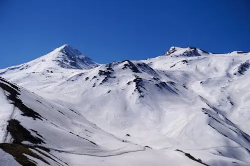
Kuari Pass sits at 12,516 feet and is reached by a 5–6 day trail that begins from the small village of Dhak or Karchi — a short drive from Joshimath. The trail passes through dense walnut, maple and oak forests, opens gradually into the vast Gorson and Chitrakantha bugyals, climbs to a high ridge at Khullara that feels like the edge of the world, and deposits you at the pass with a 180-degree amphitheatre view of the Garhwal Himalayas that has to be earned to be believed.
On one side: Chaukhamba, Neelkanth, Dronagiri, Nilgiri, Hathi Ghoda. Straight ahead: Trishul. And in the far distance, unmistakable, India’s second highest peak — Nanda Devi at 7,816 metres, the highest mountain contained entirely within the borders of India. You see her from the trail on the very first day. She never leaves you.
The route in brief
Day 1: Drive Joshimath → Dhak village (12 km) · Trek to Gulling camp (3 km, 2–3 hrs). The valley opens around you almost immediately. Apple orchards, terraced farmland, and the first glimpses of snow-covered ridges overhead.
Day 2: Gulling → Khullara (5.5 km, 3–4 hrs). Gradual ascent through rhododendron forests. Khullara sits at 11,014 feet — the first campsite where you feel genuinely high up. The sunset here on Chaukhamba is, frankly, alarming in its beauty.
Day 3: Khullara → Kuari Pass summit (12,516 ft) and return (12 km, 8–10 hrs). The ridge walk to the top, the narrow ledge section, the sudden opening at the pass — this is the day the trail justifies everything that came before it.
Day 4: Khullara → Tali Lake → Gorson Bugyal → Auli (10 km, 5–6 hrs) · Drive back to Joshimath. The descent through Gorson meadow in summer is like walking through a green painting. In winter it is a white one.
Kuari Pass — Need to Know
- Base: Joshimath (stay here night before and night after — Blackberry is 10 min from Dhak trailhead)
- Altitude gain: ~5,600 ft from Dhak village to the pass
- Total trek distance: 28–33 km depending on route variation
- Fitness: Jog 5 km in 45 min. If yes, you are ready
- Available: 10 months of the year — closed only July–August (peak monsoon)
- Winter version (Dec–Mar): Snow-covered trails, silent forests, world to yourself
- Permits: Nanda Devi Biosphere — your operator will arrange
- Nearest hospital: Joshimath primary health centre (20 km from Dhak by road)
Pangarchulla Peak: Your First Real Summit. At 15,069 Feet.
Pangarchulla is Kuari Pass’s more ambitious sibling. They share the same starting trail from Joshimath, the same forests, the same Khullara campsite — and then, on summit day, Pangarchulla demands something extra. You wake at 3 am. You start climbing in the dark. You push through snow ridges and boulder zones, steep and relentless, for 8 to 10 hours. And then you stand at 15,069 feet — also known as 4,600 metres — with a 360-degree panorama of Garhwal giants surrounding you in all directions.
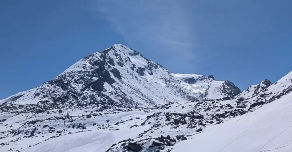
Nanda Devi, Chaukhamba, Trishul, Kamet, Dunagiri, Changabang, Hathi Ghoda — they are all there. It is the kind of view that does not fit in a photograph and takes some time to process emotionally. Trekkers who have done both Kuari Pass and Pangarchulla consistently describe the summit of Pangarchulla as the more physically demanding but the more transforming experience.
Pangarchulla is also known as the Chimney Peak, and it sits inside the Nanda Devi Sanctuary — one of the most protected and pristine alpine environments in India. The trail above the snowline is a different world: no oak forests, no rhododendrons. Just rock, ice, ridge and sky.
What makes the summit day different
The climb from Khullara to the summit covers 12 km and takes 12–14 hours round trip. The ascent involves steep snow slopes — crampons may be required depending on season — boulder zones, and a final summit ridge that requires care and slow movement. Go early. The weather window on summit morning is usually before noon. After that, clouds roll in. Your trek leader will know. Trust them.
Summit day breakfast is served at 3–4 am. Eat it. Carry energy bars, dry fruits, and chocolate in your outer pocket — reachable without removing your pack. Keep your water inside your jacket in winter so it does not freeze.
Pangarchulla — Need to Know
- Best season: March–May (snow + flowers), September–October (clear skies)
- Avoid: November onward (heavy snow makes summit very difficult), July–August (monsoon)
- Difficulty: Moderate–Difficult. Prior high-altitude experience strongly recommended
- Summit day: 3–4 am start, 8–10 hours up and down. Longest day of the trek
- Gear essentials: Gaiters, crampons, ice axe (operator-provided), three layers minimum
- Base: Joshimath. Arrive a day before to acclimatize — your summit depends on it
- Group size: Operators cap at 10–12. Smaller groups have a better summit rate
Gorson Bugyal: The Meadow That Does Not Ask Too Much of You
Not every mountain experience needs to be a summit. Sometimes a meadow is enough. Gorson Bugyal is a vast alpine meadow at 10,023 feet, roughly 3 km from Auli by trail, and the views it gives you — Nanda Devi, Mana Parvat, Dronagiri, Hathi Parbat, Kamet, all laid out in a long, unbroken wall of white — are as spectacular as anything you will find on Kuari Pass or Pangarchulla, just without the full-body effort.
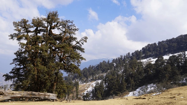
In spring, the meadow is carpeted in wildflowers. In winter, it is covered in deep, undisturbed snow, and trekkers make the climb from Auli through oak and deodar forest to arrive at a landscape that looks remarkably like Switzerland and is utterly, perfectly silent. In summer, local shepherds bring their flocks up here. The grass is at its most vivid green. The Himalayan black bears are somewhere in the tree line, doing their business.
Gorson Bugyal is the perfect first-night-in-Joshimath option. It is an ideal warm-up before Kuari Pass. It is what families do when one half wants a gentle hike and the other half wants to ski at Auli. It is many things. And it is very easy to love.
Gorson Bugyal — Need to Know
- Starting point: Auli (take the ropeway from Joshimath — Asia’s second longest cable car)
- Trek: 3 km from Auli, 1–2 hours up. Suitable for all fitness levels
- Season: April–June and September–December are ideal. Avoid monsoon
- Accommodation: No stays on the bugyal itself. Stay at Auli or Joshimath (Blackberry is your base)
- Carry: Water, light snack, camera, and layers — weather can shift quickly
- Entry fee: Forest department fee payable at the trailhead
Valley of Flowers: The UNESCO Trek That Only Opens for Eight Weeks
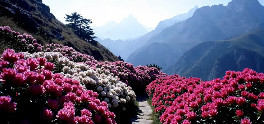
There is a reason the Valley of Flowers is a UNESCO World Heritage Site. And it is not the views, remarkable as those are. It is the flowers. Over 500 species of alpine flora — Himalayan blue poppy, brahmakamal, cobra lily, anemone, geranium, primula — bloom in a 87-square-kilometre valley between August and September in such extraordinary density and variety that botanists have been coming here since Frank Smythe discovered the valley in 1931 and could not quite believe what he was seeing.
The route from Joshimath is straightforward: drive 26 km to Govindghat, cross the Alaknanda river, trek 14 km up to Ghangaria (the last village before the valley), and from Ghangaria walk 4 km into the valley itself. The return journey mirrors the ascent. The whole experience is typically done in 6–7 days with a base at Ghangaria.
What most people do not plan for is the first and last night. You arrive into Joshimath or Govindghat the evening before, and you return to Joshimath the evening after. These are not wasted nights. They are recovery nights — when the hot meal, the warm bed, and the quiet of the mountains after four days of altitude do something important for your body and your memory.
THE VALLEY OF FLOWERS DOES NOT LOOK REAL. AND THAT IS NOT A METAPHOR. BOTANISTS HAVE BEEN DOUBTING THEIR OWN EYES HERE SINCE 1931.
Valley of Flowers — Need to Know
- Season: August to mid-September only. The valley is closed outside this window
- Base: Govindghat (26 km from Joshimath). Ghangaria for trek nights
- Difficulty: Easy–Moderate. 14 km Govindghat to Ghangaria is the longest day
- Permits: Entry permits mandatory. Your operator arranges. Do not attempt without one
- Combine with Hemkund Sahib: The Sikh pilgrimage site is 6 km from Ghangaria — most trekkers do both
- First and last night: Stay at Blackberry Cottages, Joshimath — 26 km from Govindghat trailhead
- Crowds: Go early August for fewer people. Late September is quieter but flowers are past peak
Nanda Devi Base Camp: For Those Who Are Not Done Yet
Nanda Devi. India’s highest mountain within its own borders at 7,816 metres. A peak so sacred to the Garhwali people that the goddess Nanda Devi — ‘the bliss-giving goddess’ — is considered the presiding deity of Uttarakhand. And getting to her base camp is a serious undertaking in a way that the other treks in this guide are not.
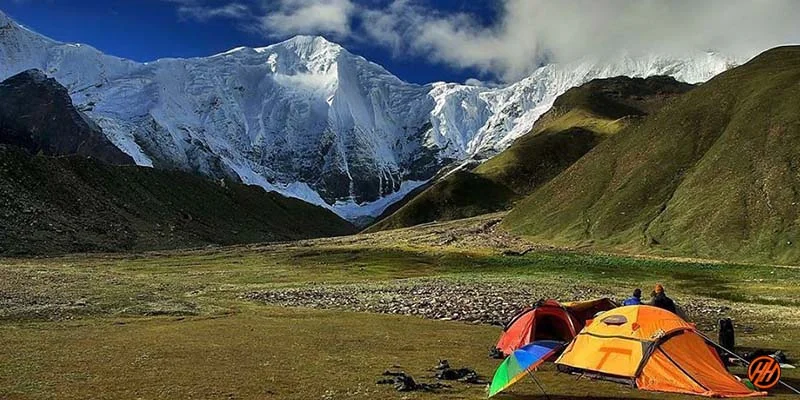
The Nanda Devi Biosphere Reserve — a UNESCO World Heritage Site since 1988 — surrounds the peak. Access to the inner sanctuary is restricted and requires special permits that not all operators can obtain. The trail typically runs 8–10 days and reaches above 14,000 feet, passing through some of the most remote and spectacularly untouched landscape in the Garhwal Himalayas. Moraines, glacial rivers, the silence of a place where very few people go. This is not a trek for first-timers. But for those who have done Kuari Pass and Pangarchulla and are wondering what is next — this is the answer.
Joshimath is the staging point for all Nanda Devi expeditions. No other route in.
Nanda Devi Base Camp — Need to Know
- This requires prior experience of at least 2 Himalayan treks above 12,000 ft
- Permits: Inner sanctuary access requires Forest Department and Wildlife Warden approval
- Best season: May–June and September
- Duration: 8–10 days minimum from Joshimath
- Difficulty: Difficult. Remote terrain, river crossings, high altitude camping
- Book with a specialist operator who has inner sanctuary permit access
Joshimath to Auli: The Short Walk That Nobody Regrets
Auli is 16 km from Joshimath by road, or a 45-minute cable car ride on what is marketed as one of Asia’s longest ropeways. It is also a roughly 2-hour walk up through forest — a walk that climbers use to warm their legs before a trek, and that families do on an acclimatization afternoon.
Auli at 8,530 feet is India’s premier ski resort in winter (January–March), and in summer it becomes a high-altitude meadow of outstanding views. The ski slopes turn green. The gondola still runs. And from Auli you can walk directly to Gorson Bugyal in an hour, or descend back to Joshimath through the forest the same way you came up.
More than anything, Auli is the view. On a clear morning from Auli, the wall of peaks from Kamet to Nanda Devi to Dronagiri to Trishul is visible in one long unbroken skyline. It is the kind of view that stops conversation. The kind that makes you understand, without needing to say it, why people have considered these mountains sacred for thousands of years.
What to Bring: The Honest Packing List
Experienced trekkers know that what you leave behind matters as much as what you carry. A heavy pack at altitude is not just uncomfortable — it slows your breathing, tires your legs faster, and makes the summit day harder. Here is what you actually need
Packing List for Joshimath Treks
- Layering system: thermal base layer, fleece mid-layer, windproof and waterproof outer shell
- Trekking boots: broken in, ankle-supporting, waterproof. Not new. Never new
- Trekking poles: non-negotiable on descent. Your knees will thank you
- Gloves: thin inner gloves and a thick outer pair. Frostbite is real above 12,000 ft
- Headlamp: Pangarchulla summit starts at 3 am. So does Hemkund. Bring spare batteries
- Water: 2 x 1-litre bottles minimum. Water purification tablets for stream crossings
- Snacks: energy bars, dry fruits, dark chocolate, nuts — carried in an outer pocket
- Sunscreen SPF 50+: mountain UV at altitude is intense. Reapply every 2 hours
- Personal medication: altitude medicine (consult your doctor before), basic first aid
- Sleeping bag: rated to -10°C minimum even in summer seasons
- What NOT to bring: jeans (absorb water, dry slowly), perfume (attracts insects), heavy books
When to Come: A Seasonal Guide to Joshimath Treks
The Joshimath trekking calendar has four distinct seasons, each with a completely different character. Unlike the more famous treks of Himachal Pradesh where summer is the only viable window, here the mountains are generous. They give you ten months of the year to work with.
Winter — December to March
The trails are covered in snow. The forests are silent. The campsites feel like being the last person on earth. Kuari Pass in winter is the peak version of itself — white meadows, frozen streams, the kind of cold that makes every cup of tea taste extraordinary. Gorson Bugyal becomes a snow bowl. Pangarchulla is for experienced winter trekkers only. Valley of Flowers is closed.
Spring — April to June
The rhododendrons are insane. Pink, red and white bursting through the forest on every trail. Snow is still present above 11,000 feet which gives the Pangarchulla summit its best combination of accessibility and challenge. Kuari Pass is spectacular — the meadows green below and white above. Gorson Bugyal in May is at its most colourful. Best all-round season for first-time trekkers.
Monsoon — July to August
Most treks close. The trails get slippery, leeches appear in the lower forests, and landslides make road access unpredictable. The one significant exception: Valley of Flowers, which is open only in August–September and at its absolute peak right now. If you have come for VoF, this is your window. For everything else, wait.
Autumn — September to November
The clearest skies of the year. Mountain views are at their sharpest — the summer haze is gone and the winter clouds have not yet arrived. Pangarchulla summit success rates are highest in October. Kuari Pass is perfect. Valley of Flowers transitions from peak bloom to late season. This is the season experienced trekkers prefer.
Your Base in Joshimath: Why the Night Before and After Matter
Every trek in this guide starts and ends in Joshimath. The night before a trek is not lost time — it is the night that determines how your first day on the trail goes. A good meal, an early sleep, a warm breakfast before the drive to the trailhead. The night after a trek is when you sit with it all — the soreness, the summit photographs, the hot shower, the meal that tastes like the best thing you have ever eaten because you earned it with your legs.
Blackberry Cottages is a 10-minute drive from the Dhak village trailhead for Kuari Pass and Pangarchulla. We are 26 km from Govindghat for Valley of Flowers. We are 16 km from Auli. We cook a proper meal for 5:30 am departures if that is what the trek requires. We dry gear in the evening. We have sat with enough trekkers over enough dinners to know what this part of the journey actually needs.
The mountains are out there. We are right here at the beginning and end of them. Come and see.